中文
Tilt photography technology is a high-tech developed in the field of international mapping remote sensing in recent years, by carrying multiple sensors on the same flight platform, and collecting images from different angles such as vertical and tilt, we can obtain three-dimensional data with real texture, which is suitable for large-scale urban 3D modeling, transmission line channel modeling and some 3D engineering measurement applications with slightly lower accuracy requirements. Tilt photography modeling mapping is usually solved by drones, tilt cameras, and data processing software. Hive Aerospace is equipped with a complete system solution for tilt photography modeling and mapping business.
Hive drone system advantages
1. Fast response, mobility, flexibility
Drones usually fly at low altitudes, have easy airspace applications, and are less affected by climatic conditions and can fly under the clouds. Low requirements for landing sites (can be launched on board or ejected), short preparation time, simple operation, convenient transportation.
2. A wide range of uses and a wide range of monitoring tools
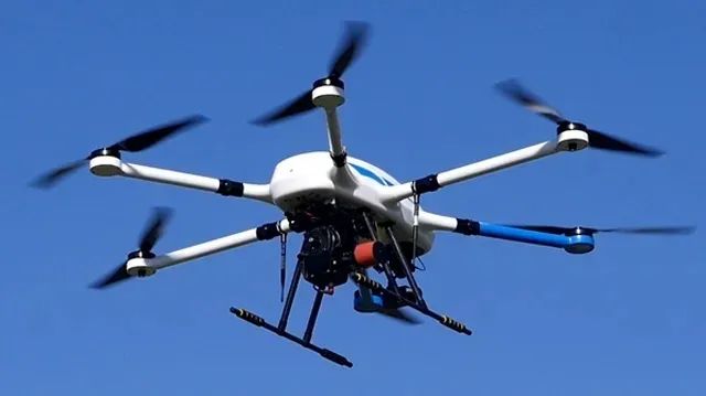
Honeycomb UAV cover a variety of models of drones, there are VTOL type, long-range time type, long-range real-time mapping type, etc. , can be applied to unmanned aerial remote sensing mapping, real-time monitoring and other scenarios, applicable to oil-related fields. Complete a variety of tasks by carrying visible-light digital cameras, tilt cameras, multispectral cameras, high-definition cameras, infrared cameras, small photopods and other task loads.
3. Fast data acquisition and high data quality
Compared with satellite and aerial remote sensing mapping systems, drones can quickly obtain Earth-to-ground image information in a short period of time, providing users with the results they need in a timely manner. Because the UAV has low-altitude flight capability, can fly under the clouds, the acquisition of aerial image resolution is high, good data quality.
4. Good environmental adaptability, no human security risks
Drones are resistant to harsh environments, can operate at high altitudes and in hot weather, and can be as close as possible to various burst sites, transmitting back real-time data, and there is no risk of personnel safety.
5. Low maintenance costs
One-time procurement investment is small, the general operating team does not exceed 4 people, after training can master the use, maintenance, post-treatment. Compared with satellites and manned aircraft, UAV systems are cost-effective to use and maintain on a daily basis.
Honeycomb UAV solution
| Components | Advantage |
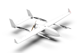
HC-332HM UAV +tilt 5 lens camera | Suitable for regular or long distance mapping. |
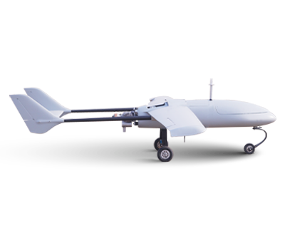
HC-332HM UAV
HC-332 With 4 hours of ultra-long flight time, heavy load, high reliability,weather resistance and other industry-leading advantages, can be widely used in agriculture and forestry monitoring, material delivery, atmospheric monitoring, power inspection, oil and gas inspection, railway inspection, security investigation, land mapping, environmental monitoring, aerial photography and other fields.
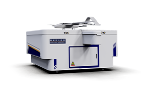
Tilt 5 lens camera
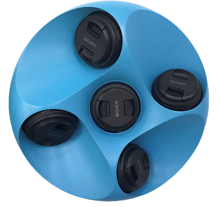
Honeycomb MAP-F51camemra use ABS material. With modular component design and multiple sensors, high precision, wide area coverage and high efficiency aerial mission shooting are achieved. The camera is compatible with a wide range of drone flight platforms and adapts to aerial missions in a variety of weather and natural environments.
Data processing system
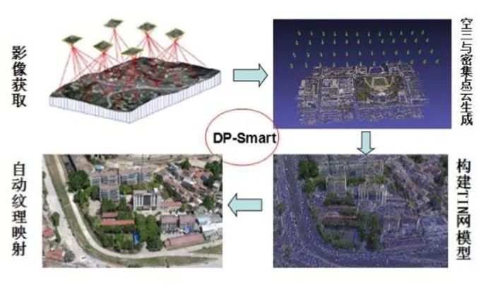
Digital Photo Smart is a set of automatic modeling software based on air-ground multi-source sequence image, which automatically generates high-resolution true 3D model without human intervention. Based on photogrammetry, computer vision and computational geometry algorithms, the software supports the rapid generation of true 3D models by supporting automatic three-computation, dense point cloud generation, TIN network construction, and automatic texture mapping.
Using tilt photography technology to obtain the tilt image and orthophoto image data along the route, the image data, POS data and field image control data are imported into the DP-Smart automatic modeling system for batch processing by reasonably laying out some field image control points. The DP-Smart automated modeling system does not require human intervention in calculating 3D model data or 3DTIN textures.

Scan the QR to Follow us on Wechat