中文
Coastal defense management is a vital component of regular governance and emergency response in coastal regions. To better perform the duty of "coastal border and maritime control" and upgrade the technical defense capability of coastal defense, the coastal defense UAV management and control system of Honeycomb Aerospace has been deployed in an eastern coastal area. It creates the conditions for all-time standby and long-distance rapid response in coastal defense management, and achieves the intellectualization, systematization, real-time performance and visualization of coastal defense management.
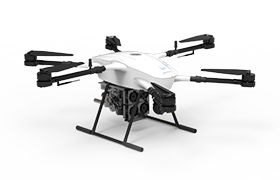
The coastal defense UAV management and control system mainly consists of three components: maritime UAV and payload system, low-altitude communication network, and UAV intelligent control system. Among these, the maritime UAV and payload system includes the coastal defense VTOL fixed-wing unmanned system and coastal defense long-endurance VTOL UAV system; the low-altitude communication network covers wireless ad-hoc network, wireless weak network transmission and terrestrial wired private network; the UAV intelligent control system incorporates unmanned aerial vehicle management and control, basic information management, defogging function and system integration.
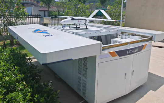
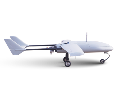
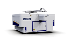
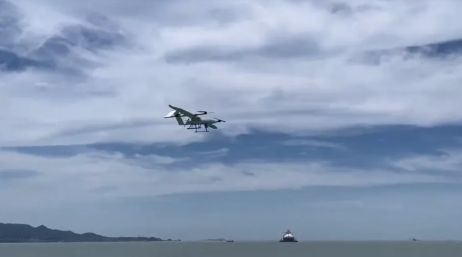
The SU-50Pro VTOL fixed-wing unmanned system is composed of an intelligent patrol UAV and an intelligent UAV cabin. Equipped with industry-leading advantages including remote control, autonomous charging, autonomous take-off and landing, and cluster autonomous operation, the system provides users with an efficient and convenient application mode, and delivers an integrated solution for long-distance and large-scale patrol scenarios such as oil and gas pipelines, forest and grassland fire prevention, border and coastal defense, river courses, and roads.
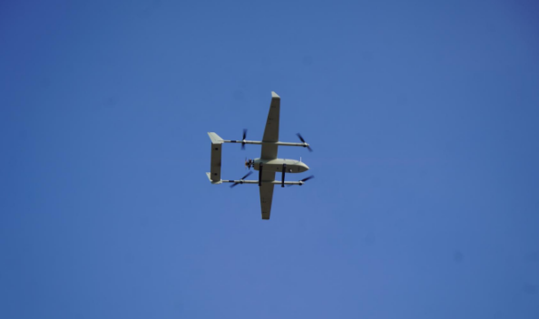
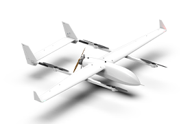
The HC-540 long-endurance VTOL UAV adopts an oil-electric hybrid power system, and features outstanding endurance and universal payload capacity. It can be equipped with various types of payloads according to mission requirements, performing diversified tasks such as regular patrols, 2D/3D aerial surveying, and special equipment transportation, and is adaptable to multi-scenario operation needs in complex environments.
Typical Application Scenarios
Large-Scale Maritime Patrol and Emergency Response
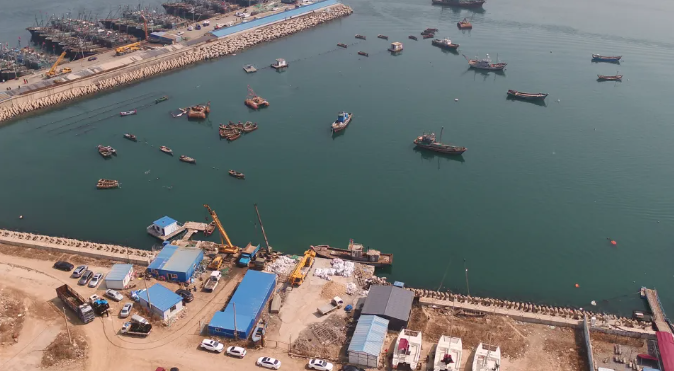
Traditional vessel patrols are slow, limited in coverage and highly susceptible to sea conditions, with patrol operations mostly carried out in a linear manner. The Honeycomb Aerospace UAV features a speed 3–10 times that of a patrol vessel. Equipped with an electro-optical camera and high-definition monitoring equipment, it features wide coverage and a broad field of view, significantly enhancing the area-based maritime surveillance capability. Combined with the air-sea coordination of a vessel and the UAV, rapid deployment and three-dimensional monitoring can be achieved, reducing manpower and cost input.
Maritime Law Enforcement and Investigation & Evidence Collection
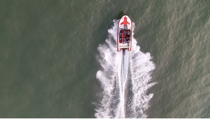
The Honeycomb Aerospace UAV has dual capabilities of high-altitude surveillance and close-range reconnaissance. By virtue of technologies such as thermal imaging and laser ranging, it can track and accurately locate suspicious vessels, complete high-definition evidence collection and situational analysis, and prevent target escape. Through the "three-dimensional patrol and control" integrating land, maritime and air coordination, it improves the efficiency and deterrence of maritime law enforcement.
Oil Spill Monitoring and Pollution Early Warning
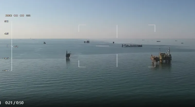
The optimal response period for maritime oil spill emergency response is only a few hours. The Honeycomb Aerospace UAV can set flight routes for regular patrols over offshore oil platforms and key water areas, detect oil leakage at the earliest opportunity, and transmit real-time dynamic images of the pollution scope and diffusion trend, thus gaining valuable time for emergency disposal and effectively compensating for the shortcomings of satellite remote sensing and traditional ground monitoring.
Navigation Mark Inspection and Waterway Mapping
For the isolated and widely distributed navigation mark facilities on islets and reefs, the Honeycomb Aerospace UAV can be equipped with dedicated inspection payloads, conduct efficient inspections of navigation mark status along pre-set flight routes, avoid unnecessary dispatches, and significantly improve inspection efficiency and accuracy. Meanwhile, by virtue of aerial photogrammetry, it enables rapid mapping of sea surface waterways and extraction of spatial data, supporting waterway planning and maintenance.
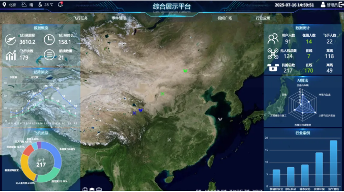
The Honeycomb Aerospace coastal defense UAV system has been put into application in multiple key coastal defense areas. It provides strong data support for maritime-related functional departments, and helps build a new smart coastal defense mode featuring real-time early warning, intelligent decision-making and precise disposal.

Scan the QR to Follow us on Wechat